


Union Level Voting District, Mecklenburg County, Virginia
About
Outline

Summary
| Unique Area Identifier | 682148 |
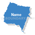
| Name | Union Level Voting District |
| County | Mecklenburg County |
| State | Virginia |
| Area (square miles) | 48.09 |
| Land Area (square miles) | 47.97 |
| Water Area (square miles) | 0.12 |
| % of Land Area | 99.75 |
| % of Water Area | 0.25 |
| Latitude of the Internal Point | 36.75993300 |
| Longtitude of the Internal Point | -78.22981580 |
Maps


Graphs
Select a template below for downloading or customizing gragh for Union Level Voting District, Mecklenburg County, Virginia


Neighbors
Neighoring Voting District (by Name) Neighboring Voting District on the Map
- American Legion Hall Voting District, Mecklenburg County, VA
- Baskerville Voting District, Mecklenburg County, VA
- Flat Rock Voting District, Lunenburg County, VA
- Park View Middle School Voting District, Mecklenburg County, VA
- Reedy Creek Voting District, Lunenburg County, VA
- Rosebud Voting District, Lunenburg County, VA
- Sunshine Voting District, Mecklenburg County, VA
Top 10 Neighboring County Subdivision (by Population) Neighboring County Subdivision on the Map
- District 6, Mecklenburg County, VA (5,205)
- District 4, Mecklenburg County, VA (3,724)
- District 7, Mecklenburg County, VA (3,000)
- Beaver Creek district, Lunenburg County, VA (1,840)
- Loves Mill district, Lunenburg County, VA (1,496)
Top 10 Neighboring Place (by Population) Neighboring Place on the Map
Top 10 Neighboring Unified School District (by Population) Neighboring Unified School District on the Map
Top 10 Neighboring State Legislative District Lower Chamber (by Population) Neighboring State Legislative District Lower Chamber on the Map
Top 10 Neighboring State Legislative District Upper Chamber (by Population) Neighboring State Legislative District Upper Chamber on the Map
Top 10 Neighboring 111th Congressional District (by Population) Neighboring 111th Congressional District on the Map
Top 10 Neighboring Census Tract (by Population) Neighboring Census Tract on the Map
- Census Tract 9302, Mecklenburg County, VA (5,979)
- Census Tract 9302, Lunenburg County, VA (4,583)
- Census Tract 9306, Mecklenburg County, VA (3,613)
- Census Tract 9303, Mecklenburg County, VA (3,276)
- Census Tract 9303, Lunenburg County, VA (2,454)
Top 10 Neighboring 5-Digit ZIP Code Tabulation Area (by Population) Neighboring 5-Digit ZIP Code Tabulation Area on the Map
- 23970, VA (8,254)
- 23924, VA (6,232)
- 23974, VA (5,012)
- 23944, VA (4,261)
- 23917, VA (3,684)
- 23915, VA (1,220)